Travel
One invisible line. 23,000 miles of detours.
Simon Reeve followed the Tropic of Capricorn through 10 countries and three continents. The line is straight. The journey was anything but.
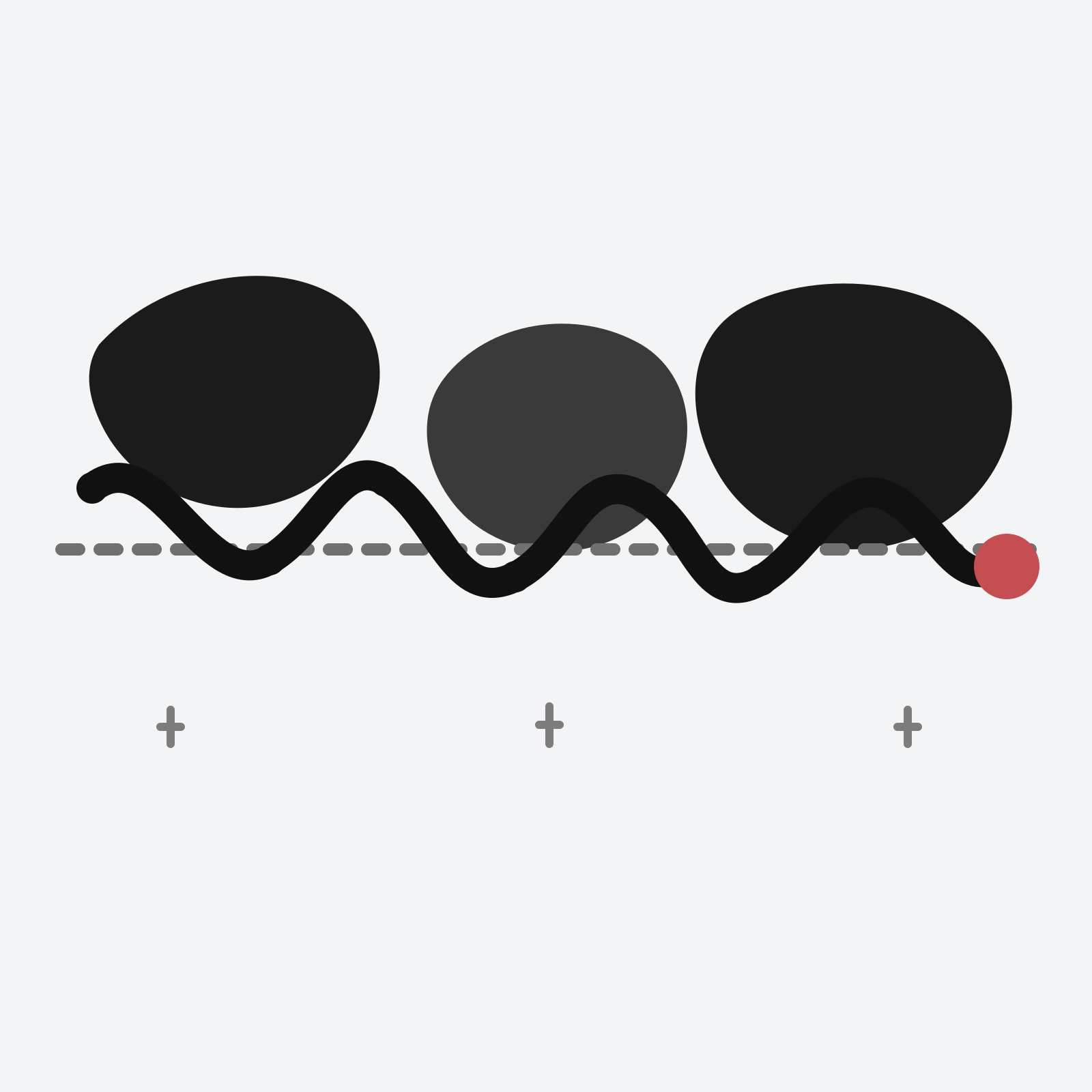
A line on a globe looks wonderfully simple.
The Tropic of Capricorn is not.
in 2008 Simon Reeve’s journey followed the southern edge of the tropics eastwards for around 23,000 miles, starting in Namibia and eventually reaching Brazil. In between came Botswana, South Africa, Mozambique, Madagascar, Australia, Chile, Argentina and Paraguay.
That makes the route easy to list — and rather harder to imagine.
Before the travel programmes
Reeve’s route into travel television was not especially direct either.
His official biography says he left school without qualifications, spent time on the dole, ran charity shops, stacked shelves and eventually became a newspaper post-boy. By his early twenties he was working undercover as an investigative journalist.
Before the long run of BBC journeys, he wrote current-affairs books covering subjects including terrorism, organised crime and nuclear smuggling.
That background helps explain the tone of the travel programmes. The geography is rarely the whole story. It is usually the way into one.
His official biography now credits him with more than 100 television programmes and travel in more than 130 countries.
Following the invisible line
The simple version of Tropic of Capricorn is a ten-country route:
Namibia → Botswana → South Africa → Mozambique → Madagascar → Australia → Chile → Argentina → Paraguay → Brazil
The first chart deliberately ignores distance and longitude. Every country gets equal space so the travel order is readable at a glance.
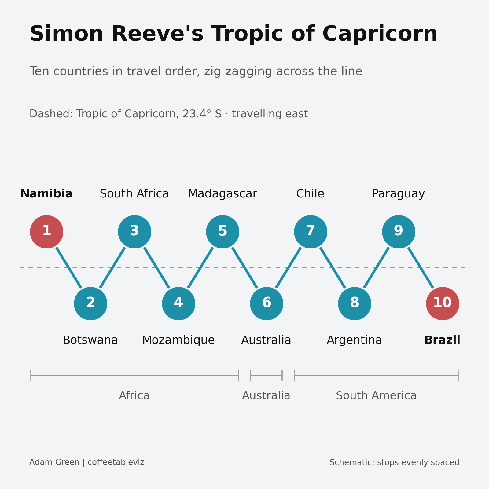
The line is the organising idea rather than the road.
The Tropic was a guide, not a road
Putting the named stops roughly by longitude makes the route more revealing.
Across Africa, Australia and South America, the journey repeatedly wanders north and south of 23.4°S instead of tracing the Tropic precisely.
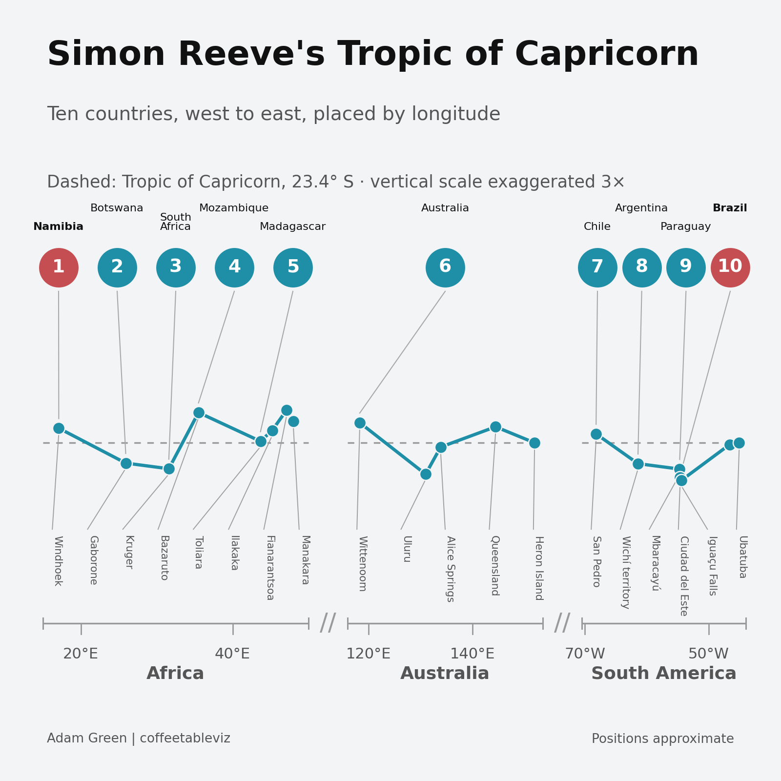
The chart exaggerates the vertical scale 3× so those deviations are visible, and separates Africa, Australia and South America into panels so the ocean crossings do not crush the detail.
It is deliberately a schematic analytical view, not a GPS reconstruction.
Eight ways to follow a straight line
Reeve’s own account names travel by van, car, train, road train, helicopter, plane, boat and horseback.
Grouped simply by how they move, that becomes four ground modes, two air modes, one water mode and one animal mode.
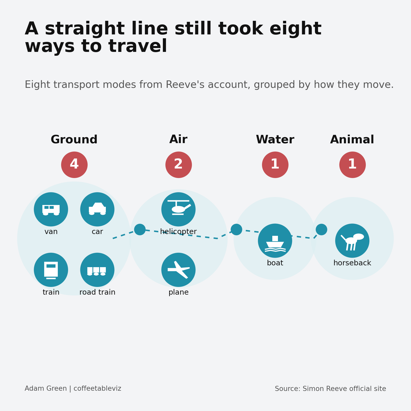
Even the transport refuses to behave like a straight line.
More than a travelogue
Penguin describes the journey as a 23,000-mile trek through Africa, Australia and South America and frames the book around changing environments, poverty and globalisation as well as the landscapes and people Reeve encounters.
That is what makes the Tropic useful as a storytelling device. It provides a simple thread through places that otherwise have very little reason to sit next to one another.
One invisible line. A lot of very visible detours.
TLDR
A straight latitude line at roughly 23.4° south became a 23,000-mile journey through 10 countries, three continents and eight named forms of transport.
The simplest lines on maps can create wonderfully messy journeys in real life.
simple charts clear stories.